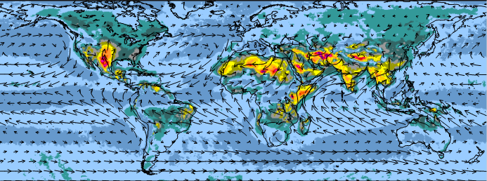
NCAR Global Climate Four-Dimensional Data Assimilation (CFDDA) Hourly 40 km Reanalysis
d604000
| DOI: 10.5065/D6M32STK
NCAR Global Climate Four-Dimensional Data Assimilation (CFDDA) Hourly 40 km Reanalysis dataset is a dynamically-downscaled dataset with high temporal and spatial resolution that was created using NCAR's CFDDA system. At the core of the CFDDA system is the 5th generation Pennsylvania State University / NCAR mesoscale model (MM5).
The dataset contains three-dimensional hourly analyses in netCDF format for the global atmospheric state from 1985 to 2005 on a 40 km horizontal grid (0.4 degree grid increment) with 28 vertical levels. As a result, the dataset provides a collection of hourly, meso-beta scale reanalyses files for all the days of the months within the 21-year period, providing good representation of local forcing and the diurnal variation of processes in the planetary boundary layer. At the time of its creation, this was the only reanalysis dataset with full three-dimensional fields available at hourly intervals.
The dataset was generated by continuously assimilating standard surface and upper-air observations. Hourly and 6-hourly surface data and upper-air measurements (primarily 12- and 24-hourly rawinsondes) were assimilated. Initial land surface conditions were based on the NASA Global Land Data Assimilation System (GLDAS) on a 1 degree by 1 degree latitude-longitude grid, compiled using the Noah land surface model (LSM), where GLDAS values for substrate soil moisture and temperature, ground skin temperature, and snow water equivalent were used. Daily sea surface temperatures (SSTs) were specified by the National Centers for Environmental Prediction (NCEP) Version 2.0 global and daily SST dataset defined on a 0.25 degree by 0.25 degree grid.
RELEASE POLICY: All uses of this dataset must be properly cited. See "How to Cite this Dataset" section below for examples of different citation styles. Additionally, notify Grace Peng (303-497-1218) of technical reports and submitted publications that use the NCAR Global Climate Four-Dimensional Data Assimilation (CFDDA) Hourly 40 km Reanalysis dataset.
| Air Temperature | Cloud Liquid Water/Ice | Heat Flux | Humidity |
| Hydrostatic Pressure | Incoming Solar Radiation | Land Surface Temperature | Longwave Radiation |
| Planetary Boundary Layer Height | Precipitation Amount | Precipitation Rate | Sea Level Pressure |
| Snow Depth | Soil Moisture/Water Content | Soil Temperature | Surface Winds |
| Total Precipitable Water | Upper Air Temperature | Upper Level Winds | Vertical Wind Velocity/Speed |
Latitude Range: Southernmost=90S Northernmost=90N Detailed coverage information Detailed coverage information 0.4° x 0.4° from 180W to 179.6E and 90S to 89.6N (900 x 450 Longitude/Latitude)
CDO: Collection of command line Operators to manipulate and analyse Climate and NWP model Data
NCO: Shell-command style, stand-alone programs that take netCDF, HDF, and/or DAP files as input and output the results in text, binary, or netCDF formats
Ncview: netCDF visual browser allowing users to visually inspect NetCDF data files
Panoply: Cross-platform application that plots geo-gridded and other arrays from netCDF, HDF, GRIB, and other datasets
IDV: Java-based software framework from Unidata for analyzing and visualizing geoscience data
 This work is licensed under a Creative Commons Attribution 4.0 International License.